← City Country Fingers | Lace of Country Streets →
QUOTE
… this pattern helps maintain the 01-independent-regions by making regions more self-sufficient agriculturally; and it will create 03-city-country-fingers almost automatically by preserving agricultural land in urban areas. But just exactly which land ought to be preserved, and which land built upon?
Notes
Finally — a pattern that won’t take an hour!
This pattern is largely related to the interaction between development and geography. Specifically, it makes the case that valleys — low ground — should be preserved for agricultural activity, while higher ground should be reserved for developments.
I do see how this can directly relate to 03-city-country-fingers — it was a footnote, but we did see an interesting pattern in an area of St. Louis related directly to this:
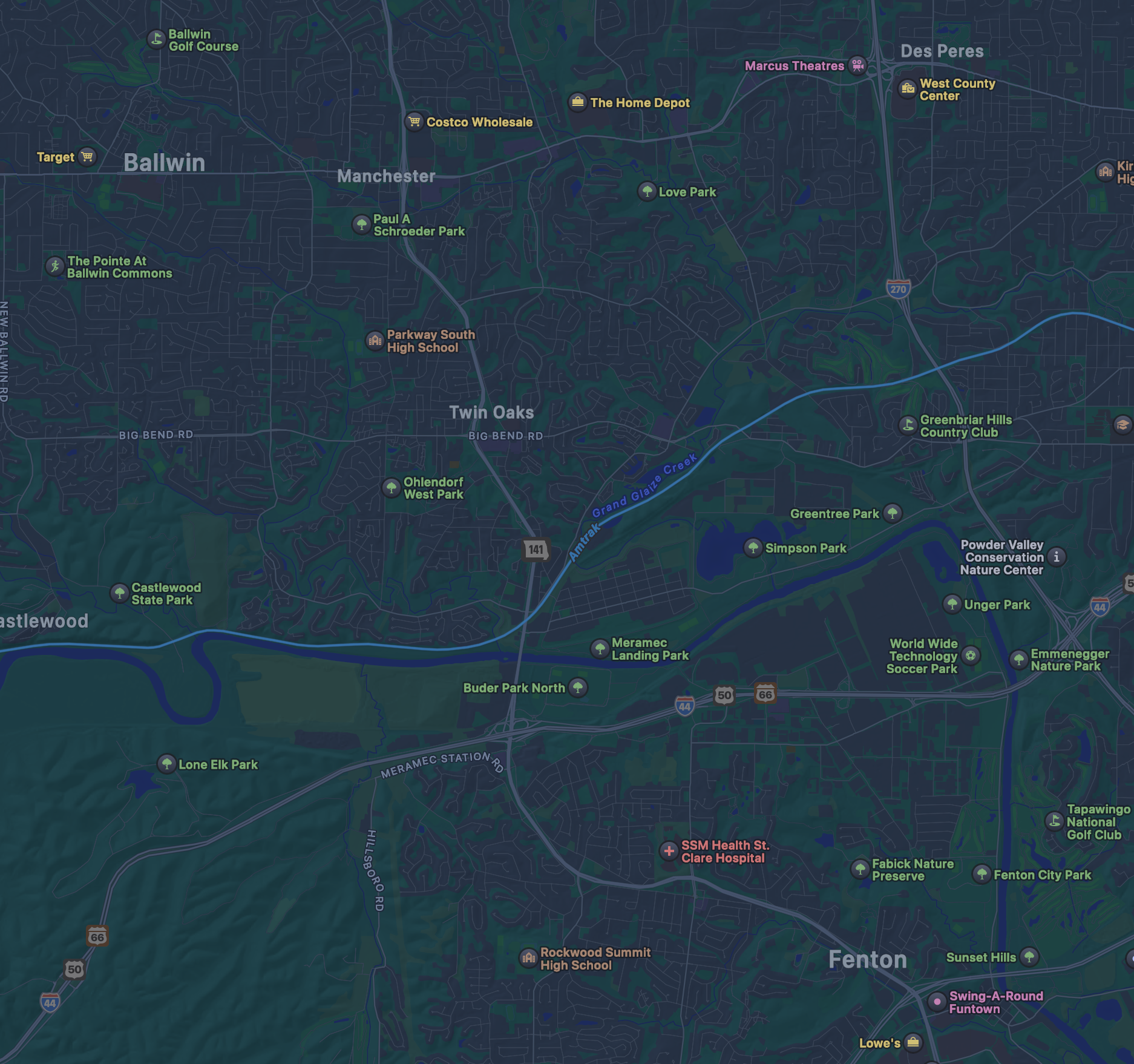
It’s a pretty well-known fact that water flows downward. We can assume, then, that the small creeks and offshoots flowing into the Meramec river from these examples are on a lower ground than their directly-adjacent development. While these may not be agricultural valleys, per se, it does still demonstrate the pattern of leaving lower-laid land undeveloped (or lightly developed) compared to the directly-adjacent higher ground.
A (crude) overlay of the topological map of the area, retrieved from the United States Geological Survey, seems to give some backing to this claim:
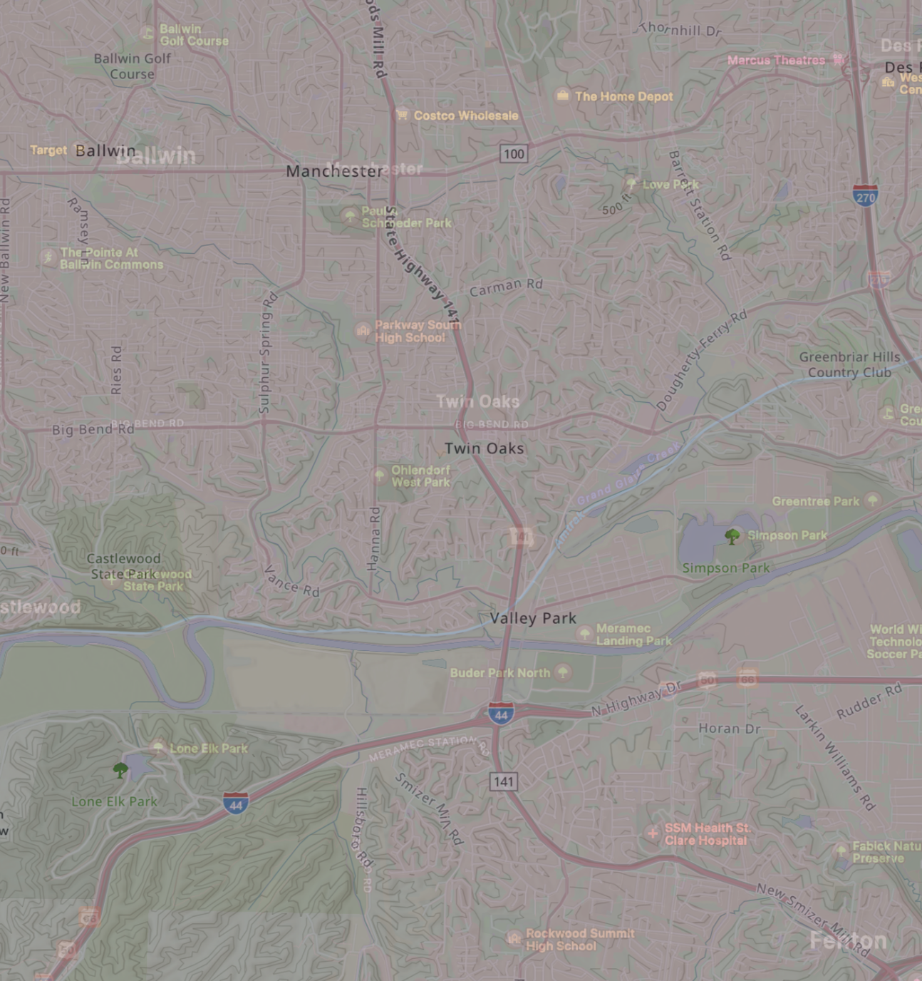
We can see clearly that many of the areas on lower-laying land — not just directly adjacent to the Maramec itself, but adjacent to its many tributaries embedded in development — remain labelled as greenlands.
As an extra data point, to try and explain what we saw in the 03-city-country-fingers analysis of Salt Lake City:
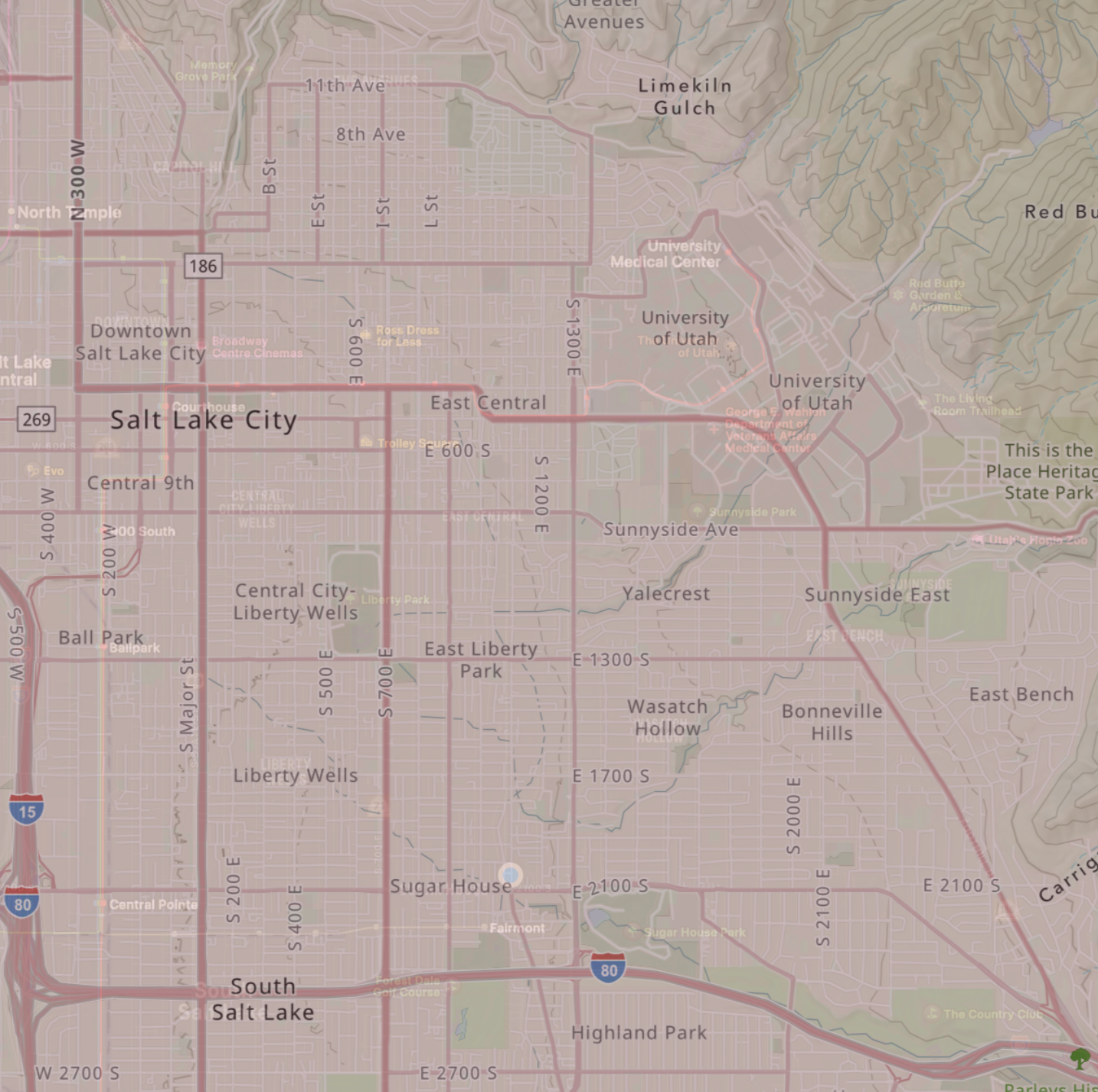
Using the same (very crude) overlay, I think this illustrates the point. While we do have some water features — the City Creek watershed, Parley’s Creek, Emigration Creek, etc. — it could hardly be said that they have the necessary tributaries to a) penetrate very deep into Salt Lake City, proper and b) don’t have enough of a fractal surface area to have preserved, by geography, the city-country finger pattern via agricultural valleys.
It’s interesting: when folks from St. Louis come to visit in Salt Lake, they talk about verticality. While the mountain view is undeniable, tributaries might create more variance in elevation — and finer fractal fingers — than a single large mountain would.